Article
2 min read
What do Maya architecture and crane runways have in common?
A laser beam can reveal what the human eye cannot, even in industrial environments.
Answer? Both can be explored with laser mapping technology called lidar. In recent years, laser mapping with a terrestrial scanner has helped identify tens of thousands of Maya structures hidden under the jungle. In a similar way, a terrestrial scanner can uncover what the naked eye cannot see in industrial environments. This is what RailQ 3D Survey does.
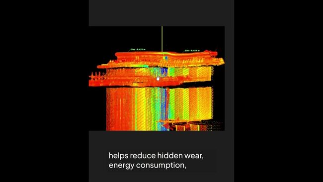
How? To inspect the straightness and wear of a 100-meter crane runway, a terrestrial scanner with a rotating laser is placed in six different positions, producing a data cloud with approximately 700,000,000 measurement points – compared to just 200 measurement points with preceding technology.
A RailQ 3D survey can spot and analyze anomalies as small as 1 millimeter in the runway.
What’s so great about it? A RailQ 3D survey can spot and analyze anomalies as small as 1 millimeter in the runway. And a 1 millimeter rail misalignment today can mean a broken rail joint or worn trolley wheels tomorrow.
Why does this matter? RailQ 3D can help reduce hidden wear, energy consumption, downtime, and safety risks, ultimately extending the life of the equipment.
What’s next? In the future, lidar technology and laser mapping will be key in exploring several other solutions utilizing AI, digital twins, automated vehicles and robotics in industrial facilities and logistics hubs.
Learn more about our RailQ 3D Runway Survey
Learn more